

DroneDash and GEODNET Establish GEODASH Aerosystems to Transform Industrial Agriculture with AI-Driven, Map-Free Spraying Drones
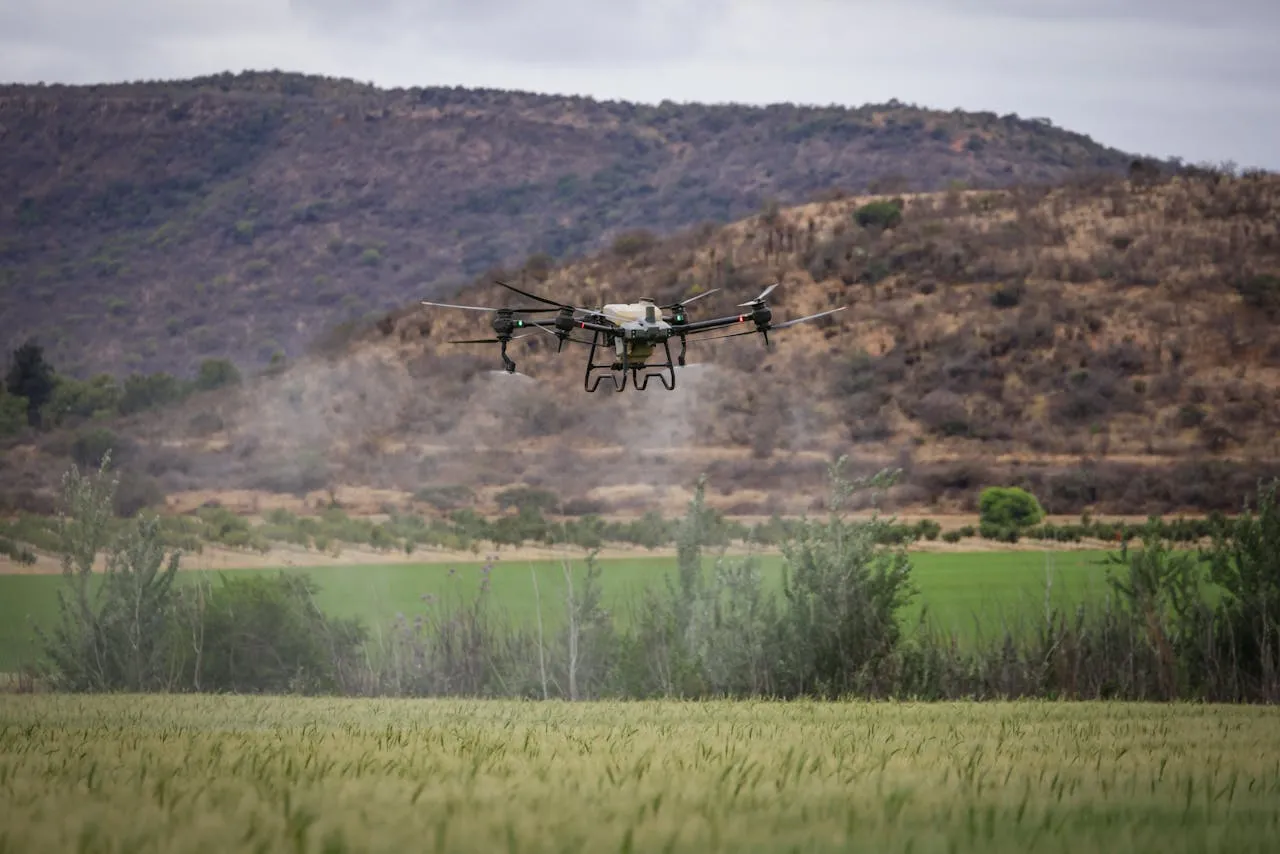
DroneDash Technologies and GEODNET, recognized globally as the largest decentralized GNSS-RTK network provider, have announced the formation of GEODASH Aerosystems Pte. Ltd., a Singapore-based joint venture focused on redefining agricultural drone operations. The newly formed company aims to introduce an advanced generation of spraying drones specifically engineered for large-scale industrial farming environments.
At the core of this initiative is a shift away from traditional drone workflows that rely heavily on manual field mapping and static mission planning. Instead, GEODASH Aerosystems is developing a platform that integrates real-time AI-powered vision systems with highly precise RTK positioning. This combination enables drones to perceive, navigate, and adapt dynamically during flight operations without requiring pre-mapped data inputs.
The result is a highly efficient, intelligent, and responsive aerial system capable of reducing operational complexity while simultaneously generating valuable agronomic insights. By merging execution and analytics into a single platform, GEODASH Aerosystems is positioning itself at the forefront of next-generation precision agriculture.
The Limitations of Conventional Agricultural Drone Systems
Despite the rapid adoption of drones in agriculture over the past decade, many existing solutions remain constrained by outdated workflows. Most agricultural spraying drones currently in use were originally adapted from general-purpose UAV platforms rather than being purpose-built for complex farming environments.
These systems typically require operators to conduct detailed field surveys before each deployment. This process involves mapping field boundaries, identifying obstacles, and generating predefined flight paths. While effective in controlled environments, this approach introduces inefficiencies in dynamic agricultural settings where conditions frequently change.
In large-scale plantations such as oil palm estates or expansive row-crop farms, the limitations of this model become particularly evident. Terrain variations, crop growth cycles, and environmental factors can quickly render pre-mapped data obsolete. As a result, operators are forced to repeat mapping procedures multiple times throughout a growing season.
This reliance on manual pre-mapping creates several operational bottlenecks:
- Increased labor and time requirements before each mission
- Reduced scalability for large agricultural operations
- Limited responsiveness to sudden changes in crop conditions
- Inefficiencies in handling mixed-age crops and uneven terrain
- Repeated mapping cycles following replanting, pruning, or natural events such as erosion
Collectively, these challenges restrict the number of hectares that can be covered within a given timeframe and delay critical interventions such as pest control or nutrient application.
A New Paradigm: Dynamic, Intelligence-Driven Drone Operations
GEODASH Aerosystems addresses these limitations by fundamentally rethinking how agricultural drones operate. Instead of relying on static pre-mission planning, the company’s platform is built around real-time intelligence and adaptive decision-making.
The system integrates DroneDash’s proprietary AI Vision technology, which enables the drone to analyze its environment continuously during flight. This includes identifying plantation structures, measuring canopy height, and detecting terrain variations in real time. At the same time, GEODNET’s RTK correction network provides centimeter-level positioning accuracy, ensuring precise navigation and consistent coverage.
By combining these technologies, the platform eliminates the need for manual field mapping altogether. Drones can be deployed immediately, interpret their surroundings dynamically, and adjust their flight paths as conditions change.
This approach unlocks several key operational advantages:
- Immediate deployment without pre-surveying or mapping
- Real-time interpretation of rows, trees, and operational zones
- Adaptive altitude control based on terrain and canopy variations
- Variable spray rates tailored to specific crop conditions
- Rapid redeployment following field changes or reconfiguration
Rather than relying on predetermined instructions, each drone generates situational awareness autonomously during flight. This enables a level of flexibility and efficiency that traditional systems cannot match.
Precision Spraying Meets Intelligent Adaptation
One of the most significant benefits of the GEODASH Aerosystems platform is its ability to deliver highly precise and adaptive spraying operations. Traditional drones often apply uniform spray rates across entire fields, regardless of variations in crop health, density, or environmental conditions.
In contrast, GEODASH drones can perform tree-level and zone-specific applications. By continuously analyzing canopy density and plant conditions, the system adjusts spray output in real time, ensuring that each area receives the appropriate treatment.
This level of precision not only improves crop health outcomes but also reduces the overuse of chemicals, contributing to more sustainable farming practices. Additionally, the system maintains strict geofencing protocols, safety parameters, and comprehensive data logging to meet regulatory requirements and ensure operational accountability.
Transforming Every Flight into a Data-Driven Insight Engine
Beyond its operational capabilities, GEODASH Aerosystems introduces a powerful agronomic intelligence layer that transforms each spraying mission into a data collection and analysis opportunity.
The platform is integrated with DroneDash’s AI Smart Farming backend, which processes data captured during flight to generate actionable insights for farm operators. Rather than functioning as a standalone tool, the drone becomes part of a broader digital ecosystem that supports continuous agricultural optimization.
Key outputs generated from flight data include:
- Detailed canopy density and uniformity assessments
- Early detection of crop stress and anomalies
- Zone-specific crop health scoring
- Validation of spray effectiveness and coverage
- Terrain mapping and drainage analysis
- Long-term trend monitoring across seasons and plantation blocks
These insights enable plantation managers and agronomists to make more informed decisions regarding crop management, fertilization, irrigation, and pest control. Early identification of issues allows for timely interventions, reducing yield losses and improving overall farm productivity.
Executive Perspectives on the Future of Smart Agriculture
Leadership from both DroneDash and GEODNET emphasized the transformative potential of integrating intelligence directly into agricultural operations.
Paul Yam, CEO of DroneDash Technologies and GEODASH Aerosystems, highlighted the importance of moving beyond traditional hardware-focused innovation:
“Agriculture does not need bigger drones — it needs smarter ones. By eliminating repetitive manual pre-mapping and embedding AI-driven intelligence into every flight, we are enabling drones to not only perform tasks but also generate meaningful insights. This allows plantation operators to improve efficiency, consistency, and overall outcomes.”
Mike Horton, Founder of GEODNET and Co-Founder of GEODASH Aerosystems, underscored the role of precision positioning in enabling reliable autonomy:
“When centimeter-level RTK positioning is combined with real-time perception and advanced analytics, it creates a foundation for predictable and dependable autonomous systems. GEODASH Aerosystems demonstrates how infrastructure-level innovation can support both operational accuracy and data-driven agricultural management.”
Target Markets and Global Expansion Strategy
GEODASH Aerosystems is initially focusing on regions and crop types where large-scale operations demand high efficiency and precision. Key target markets include:
- Oil palm plantations across Southeast Asia
- Large-scale corn, soybean, and sugarcane farms in the United States
- Broad-acre agricultural estates in South America
These markets are characterized by vast land areas, diverse terrain conditions, and increasing pressure to optimize productivity while reducing environmental impact.
The company has already conducted pilot deployments and system validation trials throughout 2025 and early 2026. These trials, carried out in collaboration with plantation operators, have provided valuable feedback for refining the platform and ensuring its readiness for commercial use.
Commercial Launch Timeline and Industry Impact
GEODASH Aerosystems is targeting a full commercial rollout in the third quarter of 2026. This timeline aligns with the completion of manufacturing readiness, regulatory approvals, and final system optimizations.
The introduction of map-free, AI-driven spraying drones represents a significant step forward for the agricultural technology sector. By removing traditional bottlenecks and integrating intelligence directly into operational workflows, GEODASH Aerosystems has the potential to redefine how large-scale farming is conducted.
As the global agriculture industry faces increasing challenges related to labor shortages, climate variability, and the need for sustainable practices, solutions that combine automation with actionable insights will become increasingly critical.
GEODASH Aerosystems’ approach—merging real-time perception, precision positioning, and advanced analytics—offers a compelling vision for the future of industrial agriculture: one where every flight not only performs a task but also contributes to a smarter, more resilient farming ecosystem.